Launching Soon
GeoTalkAI
Transforming GIS with the power of Natural Language. Just type what you want, and GeoTalkAI handles the complexity.
See It In ActionTransforming GIS with the power of Natural Language. Just type what you want, and GeoTalkAI handles the complexity.
See It In Action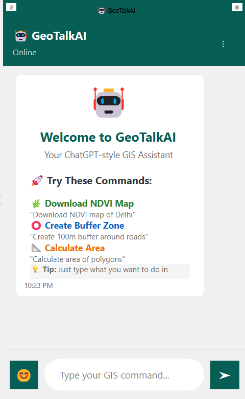
The interface is designed to feel like a familiar chat app, but with powerful GIS capabilities under the hood.
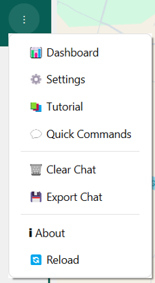
Manage your workflow effectively with our comprehensive tool menu.
Run complex GIS tools using simple English commands.
Instant access to NDVI, elevation, and land cover data.
Buffers, clipping, and analysis handled automatically.
Seamless support for Shapefile, GeoJSON, and KML.